No satellites.
So how were old maps this accurate?
Can't play sound? The illustrated version is right below.
Read the transcript
The full narration of the video.
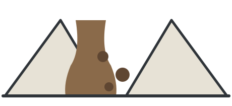
No satellites. So how were maps from a century ago this accurate? Lay an old British map over a satellite image, and the coasts, rivers and towns almost line up. There were no aerial photos then. Surveyors relied on triangles.
Try a little experiment. You want to know how far a tree across the river is, but you can't cross. So measure a straight line along your bank, say a hundred meters, with a pole at each end. From each pole, sight the tree and measure the angle against your line.
One side plus two angles locks the triangle. How far is the tree? A bit of math on paper tells you. Angles are easy: stand on one hilltop and sight another, no climbing, no crossing rivers. The only hard part is that one line, so all the effort went into it.
They picked the flattest ground and laid metal bars end to end, under tents, so the sun wouldn't stretch them. One such line in the UK ran thirteen kilometers. Re-measured electronically over 130 years later, it was off by just over two centimeters. With that one line, you can spread outward, like laying floor tiles.
Get the first tile exactly right, and the next one goes against its edge. Each triangle's calculated side becomes the known side of the next; measure two more angles and it's locked too. Triangle by triangle, the network spread from the coast into the mountains, across the whole country.
This is called triangulation, and each fixed corner point is a triangulation station. Many hilltops still have a concrete survey marker: that's a triangulation station, one corner of a tile. You can even check the seams: at the far end, measure another line and compare it with the math.
Across more than a thousand kilometers of Britain, the whole network was off by only about twenty meters. Triangles measure height too: sight the angle up to a peak, and you can work out how tall it is. Surveyors in India worked out Mount Everest at about 8,840 meters, only about nine meters short of today's figure.
In China, under the Kangxi Emperor, missionaries and officials also used triangulation to map the empire. But where the triangles never reached, old maps could be wildly wrong. A West African mountain range sat on maps by over forty mapmakers for nearly a century. Then someone walked there and found not even a decent hill.
So whether an old map is accurate depends on whether the triangles reached that spot. When you've climbed a hill, have you ever seen that concrete survey marker at the top?
In one line
Measure one straight line very precisely, then measure angles from hilltops, and triangles can tile across a whole country.
Like laying floor tiles: get the first one right, and each next one goes against the last one’s edge.
Not what
you might think
Put simply: swap hard-to-measure distances for easy-to-measure angles.
How it
works
The rule: one side plus two angles locks a triangle. You can find how far a tree across a river is without crossing.
How accurate
was it?
One thing
it can’t do
maps were still wrong The “Mountains of Kong” in West Africa appeared on maps by over forty mapmakers for nearly a century. Around 1888 someone walked there and found not even a decent hill.
Quick check
When old surveyors tiled a country with triangles, what did they actually measure with a ruler?
Only the first baseline was measured on the ground; every other side was calculated from angles.